A Nasa-Isro initiative
A satellite jointly developed by the United States and India was launched into orbit on July 30, 2025, carrying advanced radar systems designed to produce high-resolution, three-dimensional maps of Earth’s surface.
The mission, known as Nisar (Nasa-Isro Synthetic Aperture Radar), marks the first collaboration of its kind between the space agencies of the two countries and aims to significantly improve global monitoring of land, ice and environmental changes.
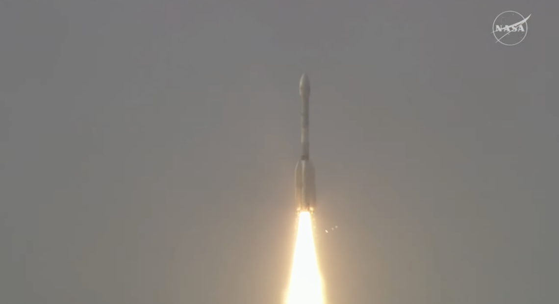
The satellite lifted off from the Satish Dhawan Space Centre in Sriharikota, India, aboard an ISRO Geosynchronous Satellite Launch Vehicle (GSLV) at 17:10 local time.
Indian ground controllers established contact with the spacecraft within 20 minutes of launch and confirmed that the satellite had reached its target orbit of 747 kilometres above Earth.
12-day cycle
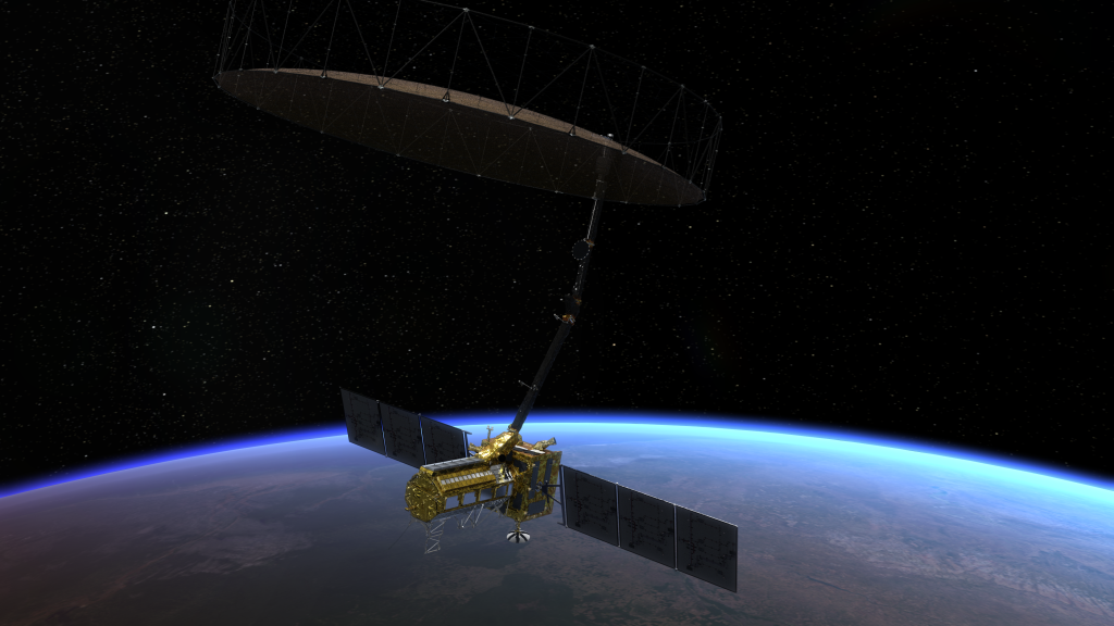
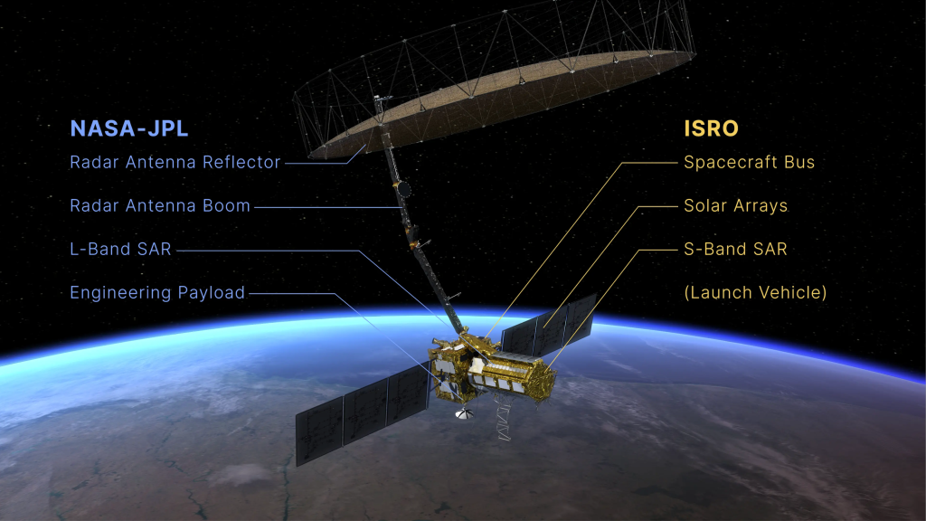
Developed by Nasa and the Indian Space Research Organisation (Isro), Nisar will scan nearly all land and ice-covered surfaces on the planet every 12 days. It uses a combination of L-band and S-band radar technologies to detect minute changes in terrain, such as ground deformation, glacier movement, and shifts in forest cover.
The satellite’s data is expected to support disaster management efforts, especially in earthquake-prone regions, as well as long-term climate adaptation planning. According to the UN Office for Disaster Risk Reduction, Asia and Africa remain the world’s most disaster-affected regions, with floods and droughts accounting for over 80% of natural disasters in the past two decades.
Watch the video here:
With growing climate stress in the Middle East and North Africa, where average temperatures are rising at twice the global rate according to the World Bank, analysts say data from Nisar could help governments better track land degradation, groundwater depletion and sea-level rise.
Urban centres such as Cairo, Dubai and Riyadh, facing rapid development and environmental vulnerability, stand to benefit from enhanced infrastructure monitoring capabilities provided by the satellite.
All-weather operation
Unlike conventional optical imaging satellites, Nisar can operate in all weather conditions, day or night, and through thick cloud cover. This feature is particularly relevant for equatorial regions, including large parts of Sub-Saharan Africa and Southeast Asia, which often face persistent cloudiness during monsoon seasons.
The mission’s L-band radar, developed by Nasa’s Jet Propulsion Laboratory, is optimised for detecting deep subsurface movement and biomass changes. Isro’s S-band radar, built by its Space Applications Centre in Ahmedabad, focuses on surface-level variations such as crop growth, wetland patterns and infrastructure stress.
Together, the dual-frequency radar systems provide complementary datasets to support applications in agriculture, water resource planning, and ecosystem monitoring. The data will be freely accessible to researchers, policymakers, and humanitarian organisations worldwide.
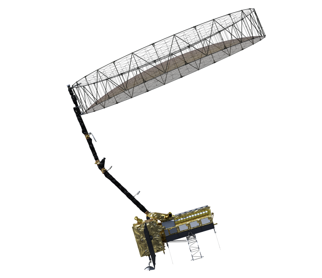
The satellite is now in a 90-day commissioning phase during which it is deploying its 12-metre radar reflector. Once operational, it will begin collecting imagery across both poles and equatorial regions, including territories rarely covered by existing Earth-observation satellites.
India’s Isro described the launch as the GSLV’s first mission into a sun-synchronous polar orbit. The mission also highlights the country’s increasing role in international space collaboration. India’s space budget for the fiscal year 2024–25 was increased by nearly 15%, reflecting its focus on scientific and commercial partnerships.
Nasa officials noted that Nisar is the most advanced synthetic aperture radar satellite to date, expanding on technologies first developed in the late 1970s. Previous radar missions have primarily focused on either environmental science or defence. In contrast, Nisar is designed for civilian applications and international use.
Satellite operations will be managed jointly by Isro and Nasa, with data processed at facilities in both countries. In India, the National Remote Sensing Centre in Hyderabad will oversee the S-band data analysis and distribution.
Nisar is scheduled to remain operational for at least three years. Experts believe its long-term dataset will play a key role in helping nations monitor climate change impacts, predict natural disasters, and plan sustainable infrastructure, particularly in regions under increasing environmental pressure.
Hero image: The Indian Space Research Organisation’s Geosynchronous Satellite Launch Vehicle lifts off from Satish Dhawan Space Centre on India’s southeastern coast at 8:10 a.m. EDT (5:40 a.m. IST), July 30, 2025. Credit: Isro