In a vital shipping route
A recent collision between two large oil tankers off the coast of the United Arab Emirates (UAE) has drawn renewed attention to the growing issue of GPS interference in the Arabian Gulf waters, with maritime experts warning of increasing risks to navigation in one of the world’s most critical energy transit corridors.
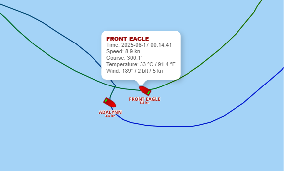
The incident took place on the evening of June 16, 2025, approximately 24 nautical miles off Khor Fakkan, a major port on the UAE’s eastern coast. It involved the Front Eagle, a Liberian-flagged very large crude carrier (VLCC) carrying crude oil to Zhoushan, China, and the Adalynn, a Suezmax tanker sailing in ballast and flagged to Antigua and Barbuda.
There were no reports of fatalities, but the Adalynn caught fire and its crew had to be evacuated by UAE maritime authorities. Satellite data from Nasa’s FIRMS system later confirmed a heat signature in the area, consistent with a shipboard blaze. The collision occurred around 21:14 UTC, with the fire detected by satellite minutes later.
While the official cause of the collision remains under investigation, cybersecurity experts have identified a contributing factor: GPS spoofing or interference that affected vessel navigation.
According to an analysis by maritime cybersecurity firm Cydome, the playback of AIS (Automatic Identification System) data from Front Eagle revealed unusual tracking patterns. At one point, the vessel’s AIS signal appeared to show it crossing land, an impossible route that suggests tampering or disruption of satellite navigation signals.
The Gulf region, particularly near the Strait of Hormuz, has seen a rise in reported GPS anomalies over the past two years, primarily attributed to the Yemen-based Houthis as well as Iranian interference.
On the day of the collision, the UK Maritime Trade Operations issued a warning about electronic interference in the area. Regional maritime bodies and private security firms have issued similar alerts.
GNSS spoofing — the deliberate transmission of false GPS signals — can mislead ships about their real-time location. While it is not yet confirmed that such spoofing directly caused the tankers to collide, experts say the incident fits a pattern of growing navigational disruption in areas where geopolitical tensions are high.
The Adalynn is also under scrutiny for being potentially linked to the so-called “dark fleet” — tankers that operate with minimal oversight and often obscure ownership. These vessels are sometimes involved in sanction-busting trade or shadow oil movements, particularly in regions where monitoring is difficult.
Vessels operating without proper P&I (Protection and Indemnity) insurance or transparent regulatory oversight face greater operational risks. When combined with cyber vulnerabilities or compromised navigation systems, the danger of accidents increases significantly.
In the Gulf, where global oil shipments pass daily, such incidents could have broader economic and environmental consequences. The Strait of Hormuz alone sees roughly 20 per cent of the world’s crude oil pass through its narrow waters.
This latest collision is not the first time concerns have been raised over the reliability of GPS-based maritime navigation in the region. Several commercial vessels have previously reported interference affecting both AIS tracking and GNSS location data.
Cybersecurity specialists argue that incidents like the one off Khor Fakkan highlight a growing need for layered maritime navigation systems that do not rely solely on GPS. Redundancy in positioning systems, improved crew training, and stricter oversight of opaque shipping networks have all been cited as areas requiring urgent attention.
As investigations continue, regional authorities and global shipping companies are expected to examine whether technology failures, lax regulatory frameworks, or deliberate interference played a decisive role in the accident.
Maritime analysts suggest that the collision may serve as a turning point in how navigation risk is assessed in the Gulf. With GPS interference becoming increasingly common, especially in areas of political friction, the challenge of ensuring vessel safety and accountability at sea is growing more complex.
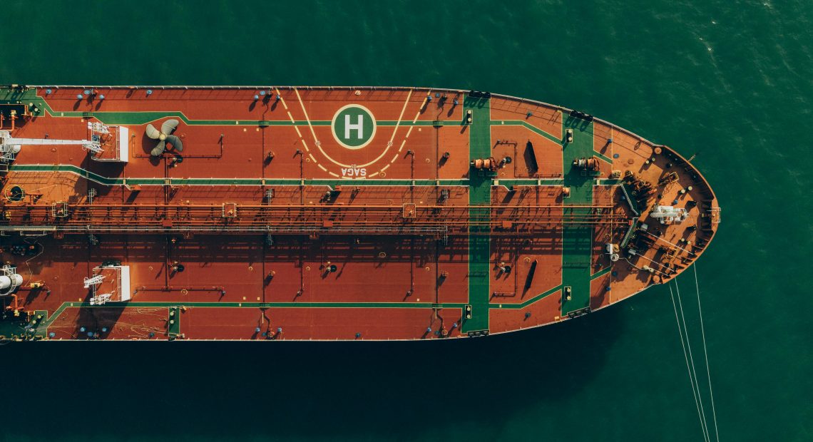
Hero image: File image of a VLCC. GNSS spoofing — the deliberate transmission of false GPS signals — can mislead ships about their real-time location. Credit: Eslam Mohammed Abdelmaksoud